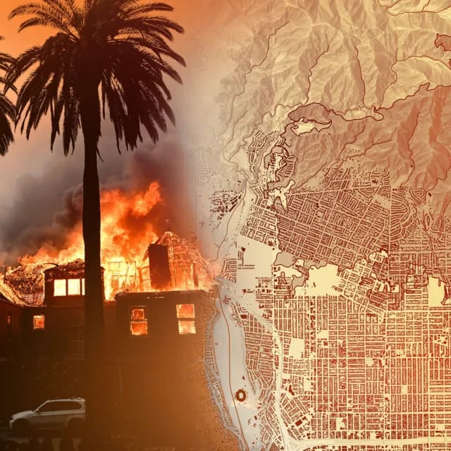
Firefighters are battling to control huge wildfires in Los Angeles that have killed at least 16 people, devoured thousands of buildings and forced tens of thousands of people to flee their homes.
It's a rapidly changing situation - these maps and pictures show the scale of the challenge, where the fires are and the damage they have caused.
The largest blaze, in the Pacific Palisades area is the most destructive fire in Los Angeles history. More than 23,000 acres have now burnt.
Placing the area affected on to maps of New York and London gives a sense of how big that is, stretching from Clapham to Greenwich in the UK's capital, or across large areas of lower Manhattan and Queens.
Three fires are currently burning in the Los Angeles area.
Palisades fire: The largest active fire is burning between Santa Monica and Malibu. Burnt area: 23,707 acres.
Eaton fire: Second largest fire burning north of Pasadena. Burnt area: 14,117 acres.
Hurst fire: To the north east of the city. Burnt area: 799 acres. It's 89% contained, according to LA officials.
But other six fires have been contained.
Kenneth fire: In the West Hills area, just north of the Palisades. It has been contained on Sunday afternoon, after burning through 1,052 acres since Thursday.
Lidia fire: Reported in the hills north of Los Angeles. Burnt area: 395 acres.
Archer fire: Small fire that started on Friday and burned through 19 acres.
Woodley fire: Small fire reported in local parkland. Burnt area: 30 acres.
Olivas fire: Small fire first reported in Ventura county about 50 miles (80km) east of Los Angeles. Burnt area: 11 acres.
Sunset fire: Reported in the historic Hollywood Hills area near many famous landmarks, including the Hollywood sign. Burnt area: 43 acres.